Size:
4 claims covering 1,700 ha
Location:
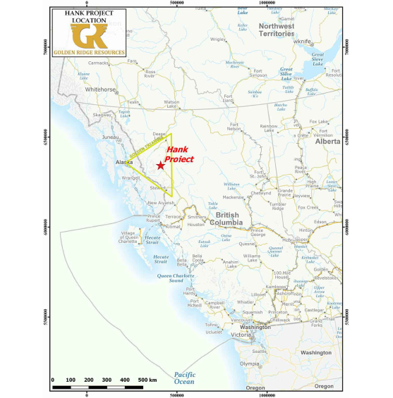
Northwest British Columbia approximately 140 km north of Stewart, BC
Access:
The mountainous and remote property is accessible by helicopter
Targets
High grade epithermal style gold-silver veins, surrounded by bulk tonnage Au-Ag-Pb-Zn mineralization in altered host rocks at the Lower Alteration Zone (LAZ) and Upper Alteration Zone (UAZ). Bulk tonnage alkalic porphyry copper-gold mineralization, similar to the producing Red Chris mine.
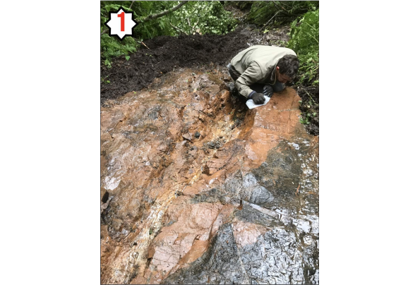
All mineralized zones on the Property are hosted within Stuhini Group volcanic and volcaniclastic strata, as well as alkaline stocks and dykes which intrude into the volcanic package and show a clear spatial association with the mineralized zones. Geological studies have suggested the intrusions were the likely source of hydrothermal fluids and gold-silver-lead-zinc mineralization on the Property.
The Upper Alteration Zone is adjacent to an important unconformable contact between the Upper Triassic Stuhini Group and Lower Jurassic Hazelton Group. The unconformity, referred to as the “red line” was recently recognized by Joanne Nelson and Jeff Kyba of the BC Geological Survey (BCGS) as playing a major role in the emplacement of all significant mineral deposits within the Golden Triangle district including Brucejack, KSM, Schaft Creek, Galore Creek, Spectrum, Saddle (GT Gold) and Red Chris. The Stuhini-Hazelton transition cuts the southwest portion of the Property as indicated by the thick red line in the Hank Project Regional Geology figure.
A feldspar megacrystic stock, known as the Bald Bluff Porphyry intrudes along its northern edge and was interpreted by Kaip (1997) as the source of the mineralizing fluids at Hank. 2017 drilling in the Lower Alteration Zone intersected intrusive rocks similar in texture and composition to the Bald Bluff Porphyry, which have a clear spatial association with high grade gold-silver mineralization. 2018 work will be focused on mapping the intrusive rocks on the Property and refining the current drill targets.

Hank Regional Project Geology Map
New alkalic porphyry discovered during the 2018 campaign and was intersected in multiple holes along a 200m strike length to a depth of 585m below surface; open along strike and at depth. The newly discovered alkalic porphyry system is characterized by bornite-chalcopyrite+/-digenite mineralized monzonite, intruding strong potassic altered intermediate Stuhini volcanics hosting veined chalcopyrite and bornite mineralization.


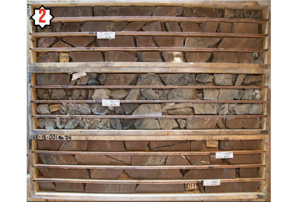
HNK-18-013: 319m of 0.34% Cu, 0.42g/t Au, 2.20g/t Ag in newly discovered ‘Williams Zone’. HNK-18-010: 20.0m of 11.63g/t Au, 13.8g/t Ag in newly discovered ‘Boiling Zone’. HNK-WZ-19-01: 278m of 0.35% Cu, 0.28g/t Au, 1.71g/t Ag continuing to define the ‘Williams Zone’ to the NE HNK-17-001: 4.13m of 19.74 g/t Au, 193.9 g/t Ag, 0.77% Pb and 1.97% Zn HNK-17-008: 0.80m of 133.00 g/t Au, 263 g/t Ag, 1.38% Pb and 0.69% Zn HNK-17-009: 21.62m of 6.26 g/t Au, 52.1 g/t Ag
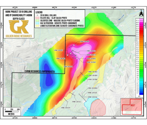
All holes drilled into the Williams zone encountered significant intervals of alkalic porphyry style alteration. An IP survey completed in 2018 suggests that the >3km long LAZ continues across Hank Creek and may connect with the Williams Zone, representing a much larger single mineralizing system than previously thought. HNK-17-009 discovered a buried intrusion with a mineralized contact zone grading 6.26 g/t Au and 52.1 g/t Ag over 21.62m. The intrusion is interpreted as one of several causative mineralizing intrusions at depth on the Property. Broad intercepts of lower grade gold surround high grade intersections over a 1.1km strike length in the LAZ demonstrating the size potential for an open-pit, bulk mining scenario in that zone.

© 2024 MMG. Todos os direitos reservados.